

 One of my favorite things about working at the Connecticut Science Center is the view of the Connecticut River. Not only is the river in Hartford beautiful, but it is constantly changing every day. The river rises and falls twice a day with the tide, and again when large rainstorms add water to the river. The most dramatic change occurs every spring when the water in the Connecticut River rises many feet from its normal level. But what is this spring flood and why does it happen so dramatically in the Connecticut River?
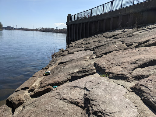
The Connecticut River in Hartford on Mar 23, 2021 – 4.5 feet high – image by Nate Gagnon
To understand this, we have to look at where all of that water in the river comes from. When you look at a map of the Connecticut River, you can see it begins near the U.S./Canadian border in northern New Hampshire and then flows south through Vermont, Massachusetts, and Connecticut until the water reaches the Long Island Sound, but it is really so much more than that!
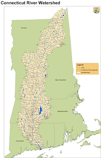
The Connecticut River Watershed – image by US Fish and Wildlife Service
A river is not only made up of the precipitation that falls directly into the water during a rainstorm. Most of the water that ends up in that river actually comes from its watershed. A watershed is the area of land where all of the rainfall and streams flow downhill and eventually make their way to the common outlet in the ocean. The Connecticut River’s watershed is massive, covering an area of 11,260 square miles! All of the water that lands in that area makes its way into the Connecticut River and adds to the overall total of water in it. So, what happens when more water is added to the river? That’s right- the height of the river rises. It is really cool because after a large rainstorm you can see this change for yourself.
Spring rainstorms are not the only or largest contributor to spring floods in Connecticut. Throughout the winter, snow and icefall on the watershed and can stay frozen for months at a time. Every snowstorm during the winter adds to this accumulation of snow. In the springtime, the temperature in New England rises and 11,260 square miles of accumulated snow melts. This melted snow flows downhill through streams, lakes, and storm drains and into the Connecticut River. This massive amount of water all flows south, passing Hartford on its way to the Long Island Sound. The water level rises throughout the river, and in Hartford we can see this change by 10 feet or more, spilling over the river banks into areas that usually stay dry throughout the year.
In early March 2021, the average river height was around 3 feet. When the water began to rise with the temperature it rose to 14 feet. Some years it rises higher, some years lower. Just recently in 2019 the spring flood rose to 20 feet! This spring may not have been as dramatic because in December 2020 large amounts of snow melted during days of sustained rain, causing a flood mid-winter. Much of the snow that would have melted in the spring melted in December instead.
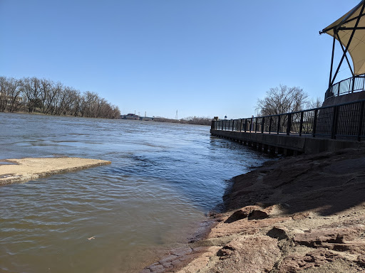
The Connecticut River in Hartford on Mar 30, 2021 – 14 feet high – image by Nate Gagnon
So the next time you take a look at the Connecticut River, take notice of its height. Is it different than the last time you looked at it? Or even the next time you are skiing up north, look at a snowflake. Will it flow past you in Hartford come spring?
To monitor the height of the river yourself, you can visit the U.S. Geological Survey link-> https://waterdata.usgs.gov/ct/nwis/uv?site_no=01190070
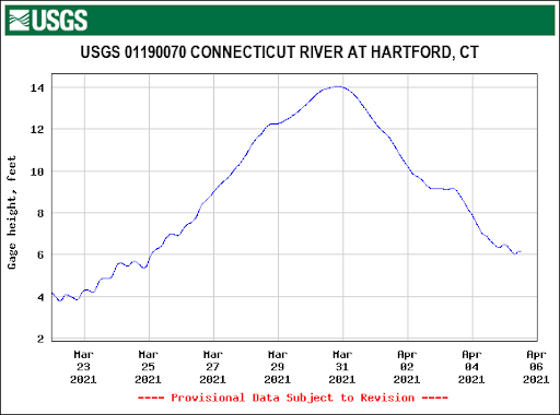
Height of the Connecticut River in Hartford March 23, 2021 through April 6, 2021 – image by U.S. Geological Survey